Tropical dry forest is one of the tropics’ most threatened ecosystems, due to the fragmentation of natural habitats. This project provides guidelines for incorporating connectivity and climate change mitigation strategies as essential components of territorial planning.
FCDS identified areas with potential for the establishment of corridors that connect patches tropical dry forest in the Caribbean region. Analysis and results were carried out at a scale of 1:250,000, and cartographic inputs at 1:100,000 and 1:250,000.
This structural connectivity analysis is intended to serve as a guide for restoration projects in tropical dry forest corridors and contribute to their conservation.
The study concluded that there are no more than 430,000 hectares remaining of tropical dry forest in the Colombian Caribbean. More than 2,190 hectares were identified as not suitable for inclusion in the corridors. More than half of these do not fulfil requirements to be included under the main categories of conservation prioritization, and are not included in the Forest Reserve area set out by Law 2 of 1959. Furthermore, 60% of these unsuitable patches are located outside of the areas prioritized by the Caribbean Regional System of Protected Areas (SIRAP), while 25% are being prospected for oil and 1% have active oil wells within them.
FCDS also analyzed the pressure that sectoral activities are exerting on dry forests, taking into account their conservation status so that connectivity corridors can be prioritized.
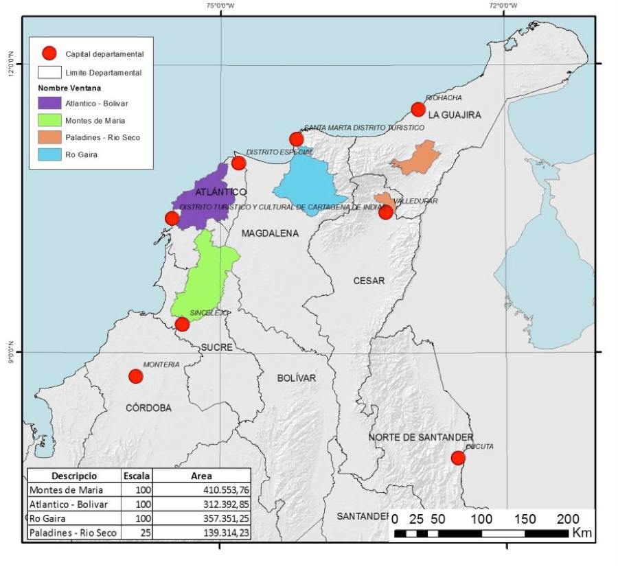
This regional level analysis studied the structure of the vegetation cover of the Colombian Caribbean, encompassing the Perijá mountain range, Montes de María and Sierra Nevada de Santa Marta, as well as the wetland complexes of the Magdalena-Cauca river.
The study used a method that assigned a value to each variable of each sectoral activity (such as petroleum, road network, mining, and agribusiness), and employed map algebra and spatial analysis of geographic information systems.
One of the study’s conclusions is that tropical dry forest connectivity corridors in the Caribbean region should be prioritized according to the number of pressures and the degree of exploitation. The regions that should be prioritized according to these parameters are, in order, Atlántico Bolívar, Montes de María and the restoration of the western sector of the Perijá mountains.
Read the document on structural connectivity here.
Read the document on prioritization according to sectoral pressures here.