The Colombian Government has set the goal of creating 2.5 million hectares of new protected areas in the National Parks System over the period 2014-2018. A section of the Peace Agreement between the Government and the FARC EP calls for the fixing of the agricultural frontier to hold back deforestation, as well as for the protection of Nature Reserves.
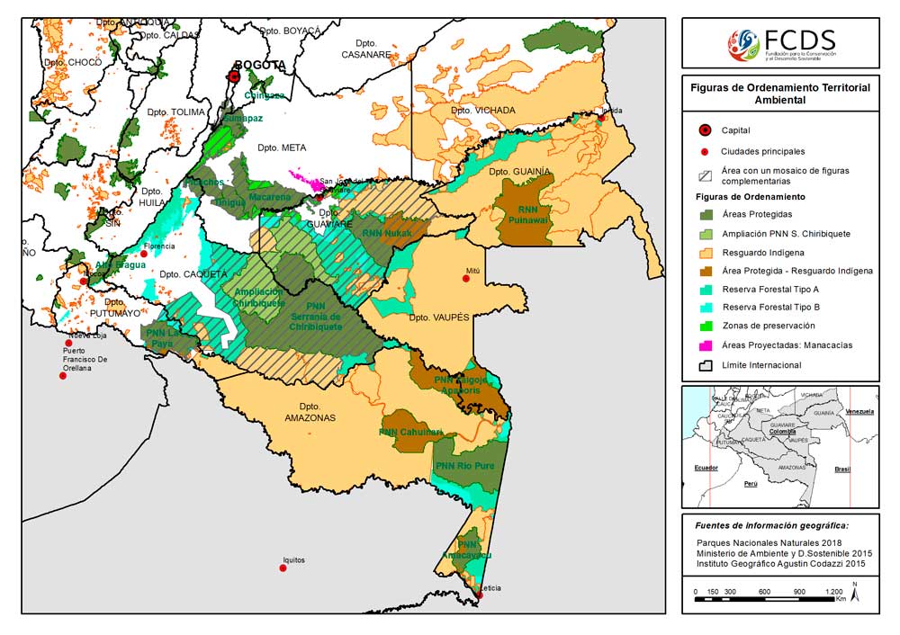
It is becoming increasingly more urgent to consolidate Chiribiquete National Park as a central pillar in the conservation of the Amazon’s most important ecosystems. Studies analyzing the impacts of road construction across the main connectivity corridor between Chiribiquete and Macarena have similarly stressed the importance of guaranteeing connectivity between the Amazon region, the Andes, and the Orinoquia.
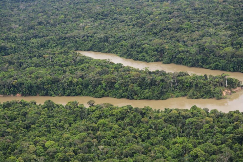
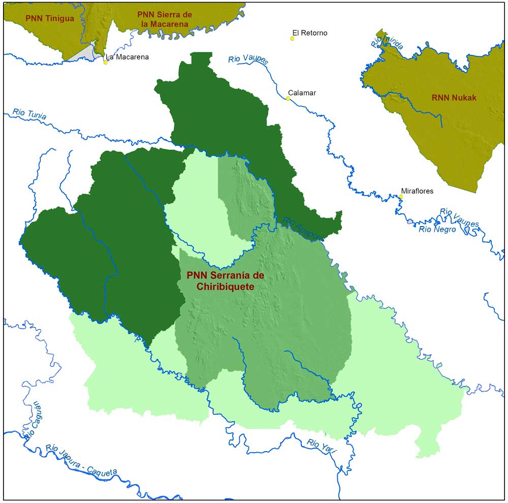
Location: The area slated for the expansion of Chiribiquete is located within the National Forest Reserve, which is one of a number of categories for the protection of the region’s forests. The area has been well conserved, as almost 100% of its ecosystems are undisturbed. It also contains the Apaporis and Vaupés river basins which contain some of the most important sources of the river Amazon, which flow with different types of blackwater (Itilla) and brownwater (Tunia)..
Main objective: support the interinstitutional process for the expansion of Chiribiquete National Park.
Courses of action:
- Support the National Park authority in producing environmental and social information to be included in the technical document which must be submitted to the Academy of Sciences as a prerequisite for the expansion of the Park.
- Support the prior consultation processes with indigenous communities required by the Ministry of the Interior.
- Accompany the publicity and institutional consultation activities that the National Park authority has built into its declaration proceedings.
Project activities
- Put together an interdisciplinary team to support the preparation of a document of technical recommendations to be submitted to the National Park authority.
- Carry out rapprochement, recognition, and socialization proceedings with the indigenous communities subject to prior consultation, to understand their expectations for the territory and define strategies to reach a consensus on the formalizing of the consultation.
- Review information on the interests of different sectors in order to adjust the final boundaries of the polygon that will be presented for the expansion, taking into account that the area that was initially requested (northern zone) may increase to include potential expansion into the western zone.
- Conserve the coordination agreement with the Ministry of Transportation and INVIAS so that guidelines on good green infrastructure practices can be incorporated into the Marginal de la Selva roadbuilding project. Take advantage of the cooperation agreement with the Governor’s Office of Guaviare to propose and support the planning of local roads in the surroundings of the expansion area.
- Continue with accompaniment and permanent consultation procedures on the ground to connect local expectations of economic development with the national, regional, and local institutional planning which must clearly state that the expansion of the protected area will mark the limits at which the agricultural frontier must be maintained.
- Compile information on threats and short-term pressures so that strategies can be made for the consolidation of the park once the expansion is declared, as well as to plan for activities prior to the expansion. The most pressing issues identified thus far are: coca cultivation, landmines, informal and illegal roads, and colonization.


